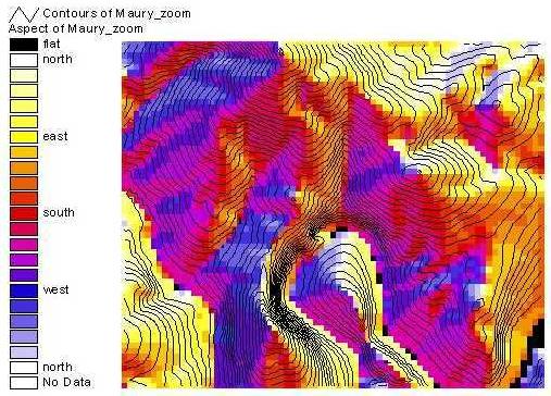
Terrain Aspect
What does that mean? Aspect is the compass direction of a line perpendicular to the slope face. So, if you were standing on a hill looking straight out, what direction you look is “aspect.” It has utility for solar power, geomorphic stability, soil development, vegetation cover, etc. (Try zooming to Blue Ridge to see deciduous vs evergreen.) This can be learned from a grid or a TIN. As shown below for the example DEM.
The topography with 20 ft contours applied.

Here’s aspect with the legend that ESRI uses. But I don’t like it. Too many colors

Here’s one I created with a different color ramp that is continuous.